


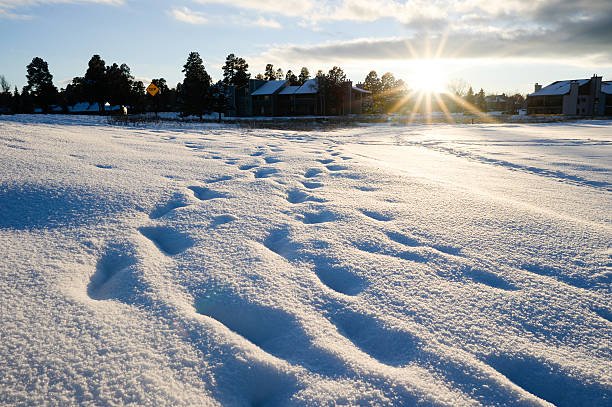
How Much Snow Will Michigan Get?
As winter takes hold in the Great Lakes region, Michigan is bracing for a major snow event this weekend (Nov 29–30, 2025), with significant accumulation expected in both the Lower and Upper Peninsulas. Forecasts from multiple meteorological services suggest a broad range of totals depending on location — from modest dustings to heavy lake-effect snow.
Snowfall Forecast by Region
- Southeast Michigan / Metro Detroit: Snow is expected to begin Saturday afternoon, with heavier accumulation Saturday evening through overnight. Most areas are forecast to receive 4–8 inches, though some spots (especially north of I-96 / I-69) could see 6–9 inches.
- West/West-Central Michigan (e.g., Grand Rapids, Kalamazoo, Lansing): Because of proximity to lake-effect bands and the storm’s path, parts of western and central Michigan may get 6–12 inches, with localized heavier bands possibly exceeding 8 inches.
- Central Michigan (including Greater Lansing area): Forecasts estimate nearly a foot of snow as part of the broader winter storm swirl.
- Upper Peninsula / Snow-belt & Lake-effect regions: These are the areas most likely to see substantial snowfall. Some lake-effect snow forecasts suggest 1 to 3+ feet in the most impacted zones — especially on the windward shores of the Great Lakes.
- Northern Lower Peninsula / Counties near Lake Michigan (e.g., Manistee, Benzie): Snow totals of 4–7 inches are forecast in many of these counties, though local conditions — wind direction, lake-effect bands — could push totals a bit higher.
What’s Driving the Snow — Storm Details
The coming snowstorm is not just a typical winter flurry. Key factors behind the heavy snowfall include:
- A strong low-pressure system sweeping through the Great Lakes region — bringing moisture, colder air, and prolonged snow-producing conditions.
- Lake-effect snow: As cold air moves over comparatively warmer Great Lakes water, it picks up moisture, which then dumps as snow on leeward shores. That’s why the Upper Peninsula and counties near Lakes Michigan, Huron and Superior are in the high-risk zone.
- Timing and temperature: Snow is expected to begin Saturday afternoon, with the heaviest accumulation overnight — a window when temperatures drop, allowing snow to accumulate rather than melt.
- Potential variability: Because of shifting wind patterns, the exact track of the storm, and variations in temperature (which influence wet vs. powdery snow), different neighborhoods may see different totals — even within the same metro area.
What This Means for Residents & Travelers
- Hazardous travel likely — especially Saturday evening into Sunday morning. Snowfall rates could hit 1 inch/hour or more, causing visibility issues and slippery roads.
- Major disruption for holiday travel — with many people traveling post-Thanksgiving, road, airport and rail traffic may face delays or cancellations.
- Mixed conditions possible — in some southern or urban parts (e.g., downtown metro Detroit), warmer pavement or slight rain-snow mix could reduce accumulation, meaning less snow on roads even if ground-level snowfall is significant.
- Lake-effect zones: be prepared — for deep snow, potential drifts, and rapid accumulation. Residents near lakes should prepare early (clear decks, stock supplies).
- Snow cleanup & delays — expect delayed commuting on Sunday morning due to sluggish plows, lingering slick patches, and potential secondary snow showers behind the main band.
What Could Change — Forecast Uncertainties
Forecasting snowfall remains an art as much as a science. Some of the things that could influence final amounts:
- A slight shift in the storm track — if the low pressure tracks a bit further north or south, areas expecting heavy snow could see less, and vice versa.
- Temperature swings near freezing — if daytime temps rise or an overshot warm front moves in, snow may mix with rain or become slushy, reducing accumulation.
- Lake-effect band behavior — small changes in wind direction can shift heavy snow bands dramatically, meaning multi-inch differences between towns only a few miles apart.
- Snow-to-liquid ratio / moisture content — wetter snow packs down heavier, yielding lower depth but more weight (dangerous for trees/power lines); dry, powdery snow yields fluffier accumulation.
Given these factors, local forecasts and advisories — especially from the National Weather Service (NWS) and regional weather offices — should be monitored closely.
Final Take: What to Expect
For many parts of Michigan this weekend — especially in Southeast and central Lower Peninsula — 4–9 inches of snow is the most likely outcome. For western, central, and lake-adjacent counties, 6–12 inches is quite possible. Meanwhile, the Upper Peninsula and snow-belt / lake-effect regions could see 1–3 feet or more depending on wind and band location.
In short: this storm seems to be a substantial early-season snowfall event, not just a light dusting — meaning significant snow, slick roads, travel disruptions, and the return of true winter conditions across Michigan.